14621, part 1: Vineyard Neighborhood and Rochester General Hospital
Year Incorporated: 1923/1957
Ward: 22
Population: 32,728 overall[/su_box]
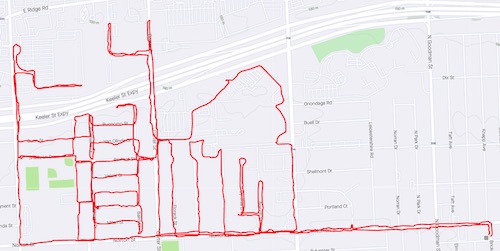
As the weather turns colder I ponder my tactics for the coming weeks and months related to this project. Should I fill in areas that I’ve already started mapping, such as the 19th Ward? Should I stay closer to home on the east side? Though I might again change my mind it occurred to me that defining the borders of the city might help me better visualize my ultimate strategy; without framing the contours of Rochester my eyes dart off into Irondequoit or Gates or Brighton. This made my choice of the northern edge of Group 14621 seem logical, and yet the sheer size of the neighborhood meant my next challenge would be to divide up the area into bikeable sections that (a) wouldn’t exhaust me, and (b) made sense in some historical context. My best resource when I don’t know where to start is almost always RocWiki, followed by the city’s official website. From there I was able to glean a handful of sub-neighborhoods: Vineyard, Polish Town, La Avenida & El Camino, Seneca Ridge, Portland Avenue and Carthage.
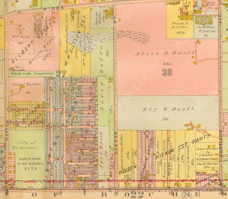
Vineyard Neighborhood was carved out of Irondequoit farmland at the turn of the 20th century. The name Vineyard is a bit limiting. The town had a reputation for wine, but also other vine products like melons and cucumbers (pickling and vinegar, too) and a fair share of dairy farming. Irondequoit was blessed with incredibly good soil, thanks to some glacial deposits some thousands of years prior, and once settlers discovered this land was soon snatched up. The population was sufficient to be organized into a town in 1839, a mere 5 years after Rochester graduated to city status. 75 years later and the city would make its first advance on this part of the town, shifting the boundary from the middle of Norton to a couple lots north, and thus retaining a sliver of the Schmidt farm, which would one day be the site of Franklin High, as well as the site of Schneider’s Hotel. Schneider’s, a sort of bawdy tavern-with-rooms-attached, attracted all sorts. Sandwiched between the city’s Polish Town and the farm lands to the north it would become a mobile office for entertainers, a rest stop for farm hands, and everyone in between.

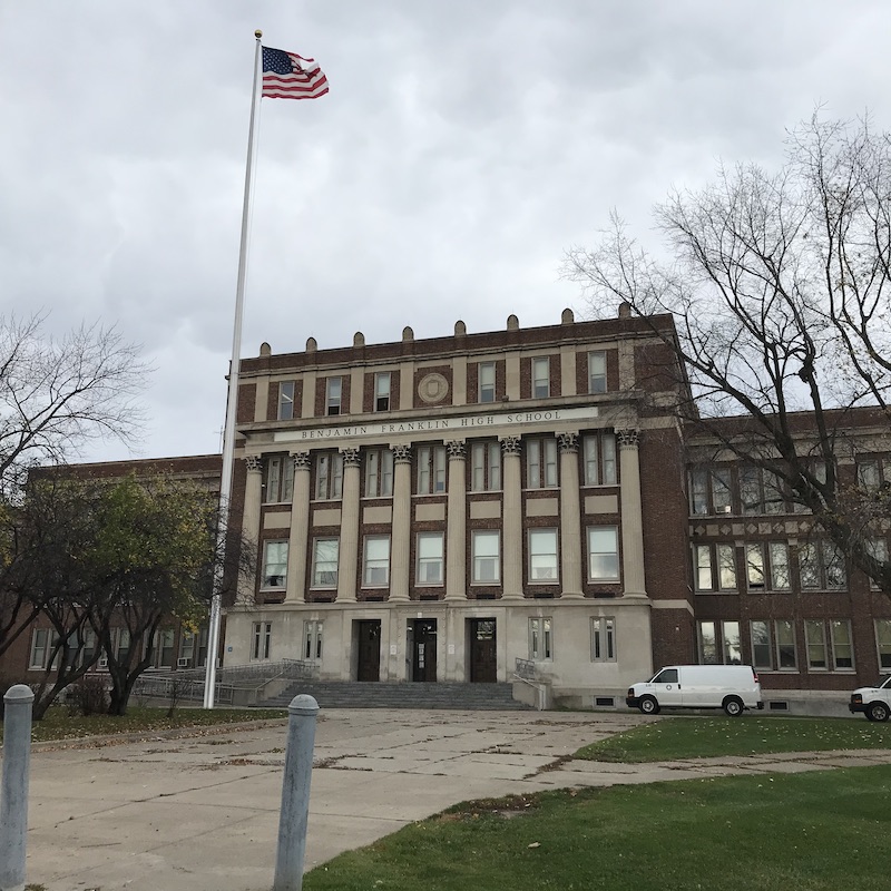
Benjamin Franklin High School had been in the works since 1917 just after the city first eyed that sliver of land just north of its border. It wasn’t until ’28 when the first shovel was employed. A. Friederich and Sons was put in charge of this massive project. This school was to be the largest the city had ever built up to that time, with room for 2500 students. Construction was projected to take 18 months at a cost of over $2 million, plus $72,520 for the purchase of land. It also served the critical purpose of relieving congestion at the other area high- and middle-schools. Class sizes were expanding faster than anyone had anticipated. By now Rochester’s population was skyrocketing, and would do so for at least another two decades.
Having met the needs of its youth, the city would soon have to attend to the needs of its aging and infirm. In the late 1940s and early ’50s Rochester faced a healthcare crisis. Most of the hospitals had been built in the 19th or early 20th centuries and had failed to keep up with the growth of the population. One such institution was Park Ave Hospital. Opened in 1894, the building briefly changed hands and closed as a hospital in 1904 before re-opening under new management in 1908. In the late ’20s a sort of United Nations of area hospitals was conceived to coordinate and manage the area’s healthcare system, and Park Ave and General Hospital found themselves under the same management.
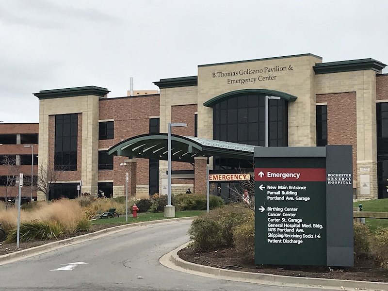
Rochester General Hospital was chartered as Rochester City Hospital in 1847, yet wouldn’t see patients until 1864. Located on West Main St, it began its life serving Civil War soldiers. In 1911 it rebranded as Rochester General Hospital, serving the general public and a wide-array of health issues. The combination of management in the ’40s is where things get confusing. Park Ave planned to open a new Park North campus at the same time that Rochester General’s Northside campus was to open. Overlapping plans led to a merger and in a relatively short period of time Park Ave hospital opened Park Ridge (now Unity) hospital, Rochester General opened near Vineyard, with the original Park Ave hospital finally closing in 1975.
This area is, in a way, an extension of the Polish Town to the south, notably including the Polish National Catholic Church of St. Casimer Cemetery, which now sits in a very unaccessible spot along a route 104 off-ramp. This neighborhood also features the only WalMart within city limits (this fact isn’t historically significant except as a footnote in the story of local food deserts and the slow decline of urban groceries).
Aside from the hospital the other big development in this neighborhood was the Route 104/Keeler Street Expressway. In the late 1960s highway expansion was a top priority in Monroe County. Traffic to and from Kodak Park in the west and Xerox in the east made for horrible congestion on the county’s east/west corridors. The concept was tossed around as early as 1951, and serious planning was underway as of 1960. This particular section of highway, connecting Goodman Street and the Veterans Bridge, was completed in 1970, and had been projected to carry over 41,000 motorists per day upon opening.
Vineyard may be an oft-overlooked section of the city, but its connections to early Irondequoit, farming, education, transportation and healthcare are significant. When appreciated with a wider lens, and especially as an extension of neighboring Polish Town, we can’t ignore the fact that roots do run deep in this part of town and pride in this neighborhood is on display. I urge anyone reading this to take a walk down the streets between the high school and the hospital. The city, and in particular Group 14621 area, has a reputation that needs to be dismissed. These streets were proof to me that the northeast quadrant deserves some more attention.

I know when you did the Polish Town piece I said that was my old neighborhood, but technically THIS is it. I didn’t know this little pocket even had a name. My mum still lives in her childhood home on the corner of Northlane Dr and VanOlinda. My parents bought their first home a year after I was born a block over on Buonomo St. My grandma told me Dunn St was originally an extension of VanOlinda and the map you provide proves that. I was the first in my family to NOT go to Franklin, which was fine with me. It wasn’t the best place in the late 80s and early 90s. I wish my dad was still around, he had some great stories about the hospital. He was the curator/director of the archives from 1983 to his retirement in 2007. You may want to check out his book he wrote in 1997 called “To Serve the Community”