UNiT, Westside Neighbors and Basket Town
Year Incorporated: 1902 and later
Ward: 24
Population: 3390
[/su_box]
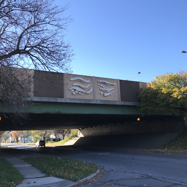
I’ll turn a phrase borrowed from an Academy Award-winning film of the ’90s to describe this neighborhood: A highway runs through it. Perhaps one of the greatest tragedies of urban planning in the last century of Rochester’s existence is the dominance of the automobile and its related land use. There were grand dreams for this west-side expanse, but nothing kills neighborhood unity like cutting it in half.
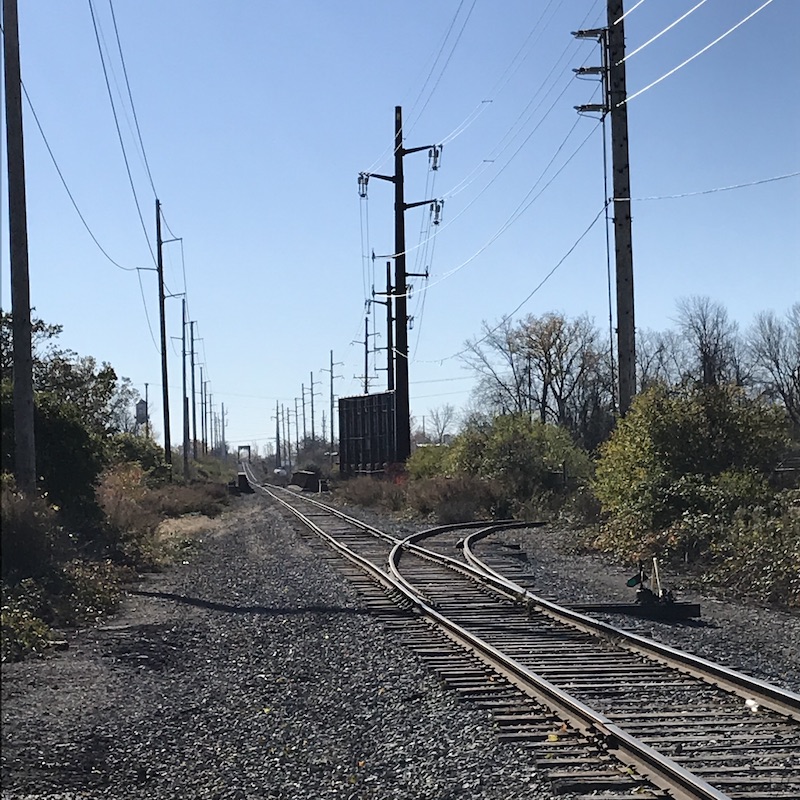
This area began as vast fields of marsh and reed, and early settlers were known to collect these reeds and weave them into baskets, and from this we get our first place name “Basket Town”. This and farming were the primary means of earning a living here until the early 20th century when Rochester expanded its borders yet again. This time land was taken from the town of Gates and vast tracts of lots were laid out on a grid to satisfy the constant urban push outward. The railroad was an ever-present force here, which made these streets more appealing to industry at first. In many regards the area was then as it is now: a place of factories and warehouses first, with residential in between. Oil, steel, glass and printing companies all had rail sidings off the Baltimore and Ohio, while companies like American Laundry Machine and Yawman & Erbe connected to the New York Central.
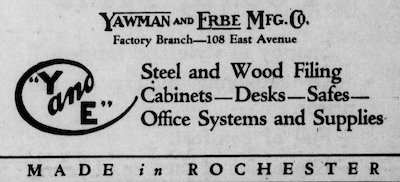
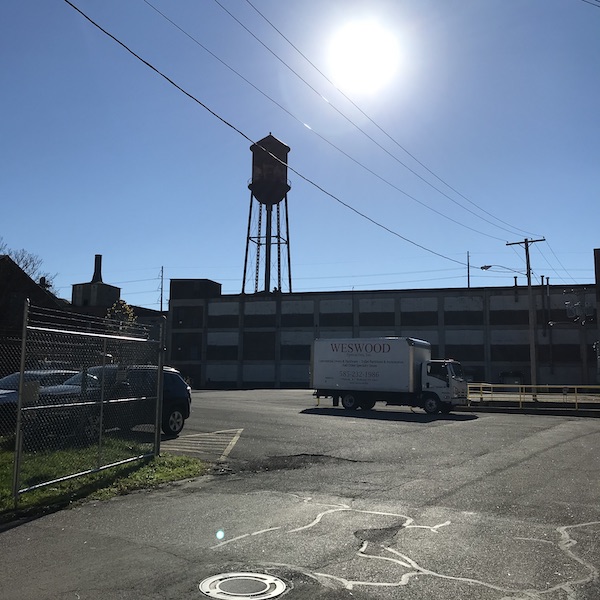
Modern industry is alive and well, for the most part, in UNiT. Dominating the real estate in the area is the Canalside Business Center, formerly the Valeo plant. Valeo was an automotive electronics manufacturer which closed their Rochester operations after 100 years in 2008. At one point they were one of the top employers in the city. Now the campus houses several small businesses. Similarly, the old Yawman & Erbe campus has been renamed Water Tower Park and is home to several businesses and artists.
Valeo has a long and storied history in Rochester. The land around the Valeo plant was once the Lamberton farm and was all subdivided to be a huge residential development just before World War II. There was a street grid laid out, with a strip along Alvanar Road that faced the canal. It was primed to be the next great post-war boom neighborhood. In fact a few houses did pop up here and there, but the boom did not happen. After the war the city, now in possession of the tract, built veterans housing. Not long after that General Electric began eyeing the parcel to expand its operations in Rochester. A small plant was operating on Lyell Ave closer to downtown, manufacturing fans and motors for small appliances and automotive applications. GE wanted to drastically scale up its manufacturing ability and it had its eye on the Lamberton site. By 1952 the 537,600 square foot plant was built, and with it some 6000 jobs. 1962 saw the construction of Route 490-West which framed the southern end of the parcel. In 1965 a merger eliminated the need for the old offices at Lyell and Whitney, and the plant at 1555 Lyell Ave expanded to near its current size. Subsequent mergers and sales saw the plant change ownership over the years. In 1994 to ITT, and then to Valeo in 1998. In the transition from GE to ITT an environmental survey was performed which identified multiple carcinogens in the soil surrounding the site. I mention this because it was this portion of my ride where I noticed a chemical odor hanging in the air, possibly a remnant of the old chemical sales building at Jay and Dodge Streets. UPDATE: I’m told the smell originates in a chemical warehouse on McKee Rd. While this may invalidate my assumption of soil contaminations it still doesn’t bode well for the residents who have to smell it every day.
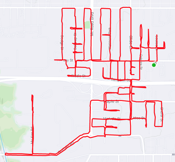
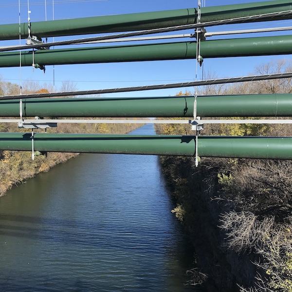
One of the great oddities about Rochester that I know I’ve remarked on before is the utter ignorance of its best resource: water. And so in the 1910s when the Erie Canal was re-routed from downtown to the border of Gates/Greece it should come as no surprise that it was entirely underutilized by the local industry. The Barge Canal was simply the first of multiple transit corridors that isolated, rather than connected, the neighborhood. A quick look at a map of McKee Road – adjacent to the canal and 490 – shows a busy industrial corridor that utilizes neither the highway nor waterway, and has in recent years even removed their railway sidings. Again I lament the prevalence of 18-wheeled cargo shipping.
Note to myself: when I compile that list of cemeteries that disappeared off the map, add Holy Family Cemetery on Maple St. This cemetery was established around the time of the Civil War and hung around until about 1955, though it’s likely graves were being removed as early as the ’40s, since at least one house had been built on the site in 1940. (Could you not wait to build your house until the cemetery is empty???). Most all of the 1400+ graves ended up in Holy Sepulchre. For the unfortunate reader who lives in the vicinity of 1123 Maple St or 120 McGuckin St, I’d avoid digging in the back yard.
Ghosts and chemical fumes aside, Westside seems like a nice neighborhood. Theodore Roosevelt School No. 43 has a decent reputation. The houses, for the most part, aren’t decrepit. The roads were (mostly) kind to bikers, though construction offered some hazards. I didn’t feel unsafe at any point in my journey, though certain parts that are strictly industrial like McKee Road or up by Ben Weitsman scrap yard really aren’t made for bikes or pedestrians of any sort. The area really only has a few negatives, and the biggest is the aforementioned highway, though the neighborhood association has done quite a bit to calm the noise and make it look somewhat nicer. I still wish we could experience what this place could’ve offered had the highway not sliced right through the middle. Maybe then it wouldn’t be so easy to speed past it at 60mph.