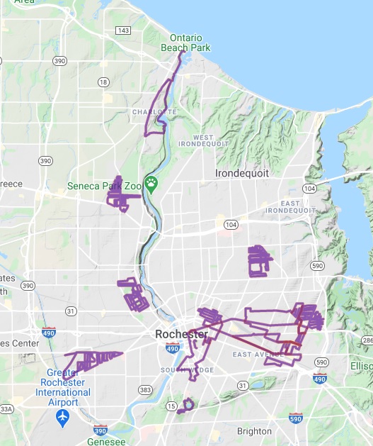
Walk the Roc
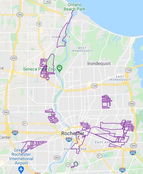
I have a lofty goal: walking or biking every pedestrian-friendly street in the city of Rochester. (I really want to color in a blank street map of the city, because coloring is relaxing, but in this case I’m the crayon.) It’s been done before, so I’m not trying to break any records. I want to see my city from a different perspective, one that allows me to notice detail and learn about different areas in a way that driving a car wouldn’t allow.
If you’re interested in keeping up, I’ll periodically update the map above to show my progress. I’m also taking pictures of significant spots along my route, since I can’t help but ponder the history of places when I’m in it. If you’re really into local history, like me, you can keep up by following my route journal, where I discuss the neighborhoods’ history and local landmarks. Here’s a list of areas that I’ve already explored:
- Barnard
- Edgerton
- Elmcroft
- Lincoln Park
- Northland & Lyceum
- South Marketview
- Tryon
- Uptonville